
Lake & Reservoir Levels in San Luis Obispo County, CA (2026 Update)
Current storage levels at Lopez Lake, Santa Margarita Lake, Lake Nacimiento, San Antonio Lake, and Whale Rock Reservoir, plus rainfall trends and 2026 water supply outlook.
San Luis Obispo County’s lakes and reservoirs are essential to the Central Coast’s water infrastructure, supporting municipal supply, agriculture, groundwater recharge, flood control, and outdoor recreation. Following several wetter-than-average winters earlier in the decade, the region entered 2026 with generally stable reservoir storage—though levels vary based on watershed performance, water releases, and regional demand.
Below is a detailed look at the county’s primary lakes and reservoirs, including current storage conditions compared to 2025 and operational outlooks for the year ahead.
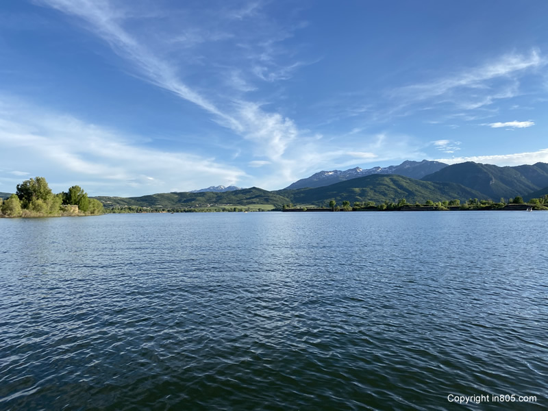
Lopez Lake
Lopez Lake, located southeast of Arroyo Grande in the Santa Lucia Range, is one of the most important municipal water sources on the South County coast. The reservoir is formed by Lopez Dam on Arroyo Grande Creek and provides water to communities including Arroyo Grande, Grover Beach, and Pismo Beach. In addition to water storage, Lopez Lake is a major recreation hub offering boating, camping, fishing, hiking, and wildlife viewing.
As of early 2026, Lopez Lake is sitting at approximately 82.9% of capacity. This represents a modest decline from 2025, when the reservoir hovered in the 93–94% full range following strong winter storm activity.
Seasonal fluctuations are typical at Lopez due to municipal drawdown during dry months and variable inflow from its relatively small watershed. Rainfall in late 2025 and early 2026 helped stabilize levels after dipping into the upper-70% range in the fall.
Operational Outlook
Storage remains well above drought concern thresholds, and the reservoir is expected to provide reliable municipal supply through 2026 barring extreme dry conditions.
Santa Margarita Lake (Salinas Reservoir)
Santa Margarita Lake—also known as Salinas Reservoir—is currently the fullest major reservoir in San Luis Obispo County. Located east of the town of Santa Margarita, the lake is formed by Salinas Dam on the Salinas River and plays a key role in both municipal supply and downstream environmental water management.
The reservoir is sitting at approximately 101.2% of capacity in early 2026, meaning it is effectively full with minor overflow storage. This is an increase from 2025, when the lake remained consistently between 96% and 99% full.
Santa Margarita Lake benefits from a larger watershed and strong runoff capture during major rain events. Because of its size and hydrologic positioning, it often fills more quickly than other county reservoirs during wet cycles.
In addition to water storage, the lake supports boating, kayaking, fishing, and camping, while surrounding lands provide habitat for bald eagles, deer, and migratory birds.
Operational Outlook
With storage exceeding design capacity, Santa Margarita Lake is in excellent condition entering 2026 and positioned to support both municipal needs and ecological flow requirements.
Lake Nacimiento
Lake Nacimiento is one of the largest reservoirs serving the Central Coast region. Located in northern San Luis Obispo County near the Monterey County line, the lake is formed by Nacimiento Dam on the Nacimiento River, a tributary of the Salinas River.
The reservoir plays a multi-purpose role that includes:
- Groundwater recharge for the Salinas Valley
- Agricultural irrigation supply
- Flood control
- Recreation and tourism
As of early 2026, Lake Nacimiento is at approximately 50% capacity, a noticeable drop from 2025 levels, which ranged between 67% and 68% full.
This year-over-year decline is largely attributed to managed releases for downstream groundwater recharge, agricultural usage, and reduced inflow compared to peak storm years. Because Nacimiento serves broader regional water needs beyond San Luis Obispo County alone, its storage levels tend to fluctuate more dramatically.
Recreation remains active at the lake, though lower water levels can affect marina access and boat launch ramp usability during late summer.
Operational Outlook
While lower than last year, storage remains within functional supply range. Future levels will depend heavily on winter rainfall and upstream watershed inflows.
San Antonio Lake
San Antonio Lake sits just north of the San Luis Obispo County boundary in southern Monterey County but is operationally tied to the same Salinas River watershed system as Lake Nacimiento. Formed by San Antonio Dam, the reservoir supports flood control, groundwater recharge, and agricultural water supply.
In early 2026, San Antonio Lake is holding approximately 56% of its total capacity, down from about 72% full in 2025.
Like Nacimiento, San Antonio’s storage is influenced by coordinated water management releases designed to recharge aquifers in the Salinas Valley—one of California’s most productive agricultural regions.
The lake is also a popular recreation site known for:
- Boating and watersports
- Fishing for bass and catfish
- Camping and RV parks
- Wildlife viewing, including tule elk
Lower levels may affect shoreline access and marina operations later in the dry season but do not currently threaten supply functions.
Operational Outlook
Moderate storage with stable operational outlook, though dependent on inflow recovery.
Whale Rock Reservoir
Whale Rock Reservoir is a smaller but strategically important water storage facility located near Cayucos. Formed by Whale Rock Dam, the reservoir supplies municipal water primarily to coastal communities including Morro Bay, Cayucos, and surrounding areas.
As of early 2026, Whale Rock Reservoir is at approximately 86.8% capacity, reflecting strong carryover storage from prior wet seasons. Public reporting on Whale Rock is less frequent than larger reservoirs, but levels have remained consistently healthy over the past several years.
Because the reservoir serves a coastal population base with relatively stable demand, storage drawdown tends to be gradual rather than extreme.
Whale Rock is not a major recreation lake; public access is limited in order to protect water quality and infrastructure.
Operational Outlook
Healthy storage levels position Whale Rock Reservoir to provide reliable coastal municipal supply through 2026.
Rainfall & Watershed Influence
Reservoir performance across San Luis Obispo County is driven primarily by seasonal rainfall and watershed runoff.
Multiple wet winters earlier in the decade allowed lakes to recover from severe drought conditions that impacted California throughout the 2010s and early 2020s. Saturated soils, replenished aquifers, and strong carryover storage have helped buffer the region against short-term dry periods.
Key hydrologic factors influencing lake levels include:
- Winter storm frequency
- Atmospheric river events
- Watershed size and elevation
- Managed water releases
- Agricultural irrigation demand
Water Supply Outlook for 2026
Municipal Water
Cities and water districts across San Luis Obispo County report stable supply conditions entering 2026. Current reservoir storage does not indicate a need for emergency drought restrictions.
Agricultural Use
Agricultural users—particularly those connected to the Salinas River watershed—continue to rely on releases from Nacimiento and San Antonio for groundwater recharge and irrigation support.
Recreation & Tourism
Lake recreation remains a major economic driver. Boating, fishing, and camping conditions are favorable at most reservoirs, with the best water access currently found at Santa Margarita and Lopez Lakes.
Summary
San Luis Obispo County’s reservoir system enters 2026 in solid overall condition:
- Santa Margarita Lake is exceeding full capacity
- Lopez Lake and Whale Rock Reservoir remain at healthy levels
- Nacimiento and San Antonio have declined but remain operationally stable
While future rainfall will determine whether storage rises or falls heading into late 2026, the region’s water outlook remains positive compared to historic drought years.